Introduction
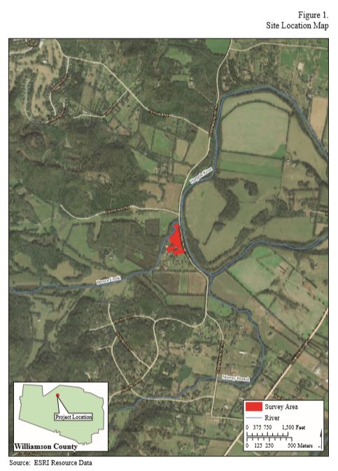
New South Associates, Inc. (New South) conducted an archaeological geophysical survey of the Old Town estate (40WM2) in Williamson County, Tennessee (Figure 1). Dr. William and Tracy Frist, who own the estate, commissioned this geophysical survey as part of their efforts to document the property’s archaeological landscape. This report reviews the site history, discusses the geophysical methods used in the survey, presents and discusses the survey results, and provides the Frist family with data to assist in the management of site 40WM2.
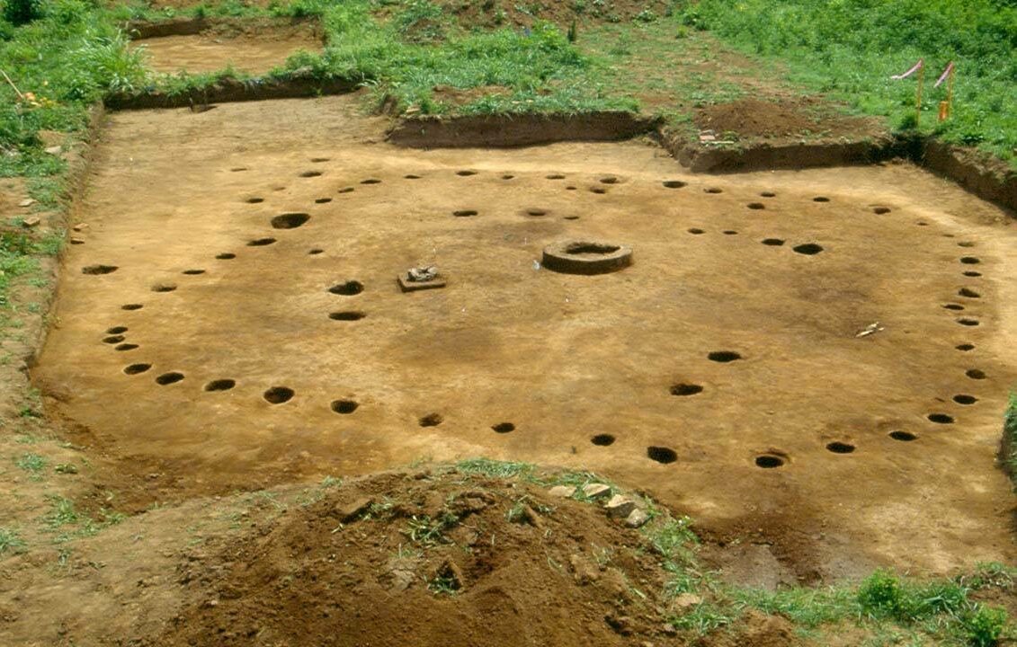

The Old Town estate consists of two primary cultural components: the nineteenth-century Thomas Brown House and the Middle Cumberland Mississippian village site. This study focused on the precontact village site; however, because the historic house, outbuildings, and pastures are located immediately on top of the site, the report takes them into consideration as well. Components from the historic and modern use of the landscape are visible in the geophysical results, and the house is listed on the National Register of Historic Places (NRHP). The Middle Cumberland Mississippian village consists of two pyramidal mounds, a small circular burial mound, another probable burial mound under the historic house, a walled village, and a large number of excavated and unexcavated stone-box graves. Both the house and the precontact village site are known as Old Town, in their respective documentation and colloquially.
Old Town is located on Harpeth River’s west bank, where Brown’s Creek feeds into it. In some sources, Brown’s Creek is called Dollison Creek or Dolarson Creek. The site rests in the low-lying Central Basin physiographic province of Tennessee, near where the Western Highland Rim meets the Central Basin. Site boundaries are generally thought to be demarcated by Brown’s Creek to the west, the Harpeth River to the east, and the confluence of the river and the creek to the north (Figure 1). The southern site boundary is unknown.
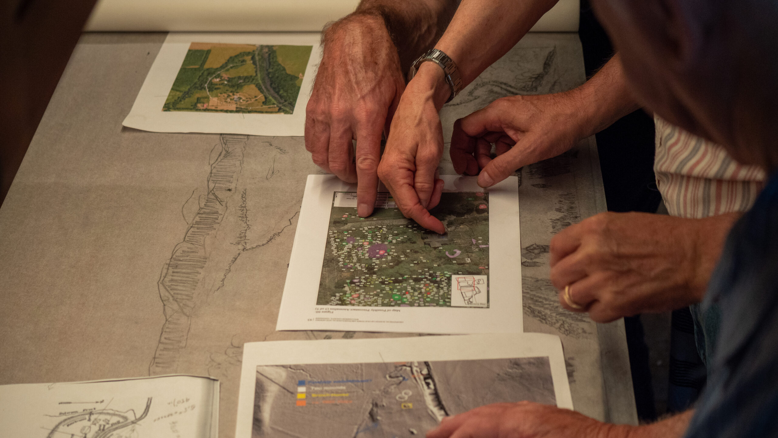
The geophysical survey described in this report included magnetic gradiometer and groundpenetrating radar (GPR) over approximately 7.25 acres, covering the areas thought to contain the main archaeological site. Fieldwork for this project was conducted between January 7 and 14, 2019. Maeve Herrick supervised fieldwork, and Sarah Lowry and Liz Mastrangelo assisted. In the geophysics results, 1,020 anomalies were identified as either modern or historic (7% or N=72) and precontact (93% or N=948). Modern or historic features are interpreted as being associated with more recent activity at the site, probably associated with the historic or present occupation of the Thomas Brown House.
Precontact features have characteristics associated with features that have been excavated and dated to that period. Modern or historic anomalies include utilities, tree roots, road, debris, garden, sidewalk, buried object, metal points, surfaces, a metal scatter, a structure, and an excavation unit. Possible precontact anomalies include stone-box graves, pits, structures, surfaces, magnetic points, middens, mound stratigraphy, mound structure, and linear features. Anomalies were categorized based on their plan and profile geometry, their context within the site, and the features expected, based on features at similar sites in the region and historic accounts.
The remainder of this report is organized as follows: Chapters II and III provide brief overviews of the environmental and cultural settings of the project area, respectively. Chapter IV describes previous research at the site, and chapter V presents the methods used in conducting the survey. Chapter VI presents the survey’s results and New South’s interpretation of them. Chapter VII summarizes the report and gives recommendations, and Appendix A provides a summary table of geophysical anomalies.